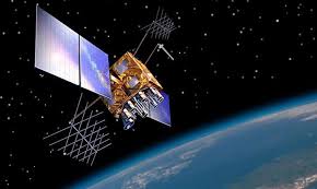
The IRNSS is now a component of the World Wide Radio Navigation System (WWRNS) and works like the Global Positioning System (GPS) and Global Navigation Satellite System (GLONASS).
Daily Current Affairs Quiz 2020
Key-Points
The Maritime Safety Committee (MSC) of IMO during its recent meeting (102nd session) held from 4 to 11 November 2020 has approved the recognition of the IRNSS as a component of the World-Wide Radio Navigation System.
This will enable merchant vessels to use IRNSS for obtaining position information similar to GPS and GLONASS to assist in the navigation of ships in ocean waters within the area covered by 50°N latitude, 55°E longitude, 5°S latitude and 110°E longitude.
IRNSS is an independent regional navigation satellite system developed by India. It is designed to provide accurate position information service to assist in the navigation of ships in Indian Ocean waters.
India has become the fourth country in the world to have its independent regional navigation satellite system recognised by the IMO as a part of the WWRNS. The other three countries that have its navigation systems recognised by the IMO are the US, Russia and China.


