When compass is used in the traversing for making angular measurement is known as compass surveying or compass traversing. In this surveying it used to determine the direction of survey line by measuring the angle with these line makes with the magnetic meridian.
The compass survey are suitable when-
- The area can not be divided into network of triangle.
- The survey details are required along the narrow strips like road, railway stream, etc
- Surveying is done in denser forest.
- Area is hilly where chaining is tedious and liable to error.
- The area is a large open tract with few noticeable features.
The compass surveying is unsuitable in places where we suspect magnetic rock or iron ore and it is less accurate than theodolite.
COMPASS- It is a compact small instrument consist essentially of a magnetic needle with graduated circle and line of sight. when the line of sight is directed towards a line the magnetic needle point c towards magnetic meridian and the angle which the line makes with the magnetic meridian is read at graduated circle.
There are two types of compass commonly used-
- Prismatic compass.
- Surveyor’s compass.
Prismatic compass- It is a commonly used very valuable instrument for rough use where speed and not the accuracy is main consideration. It was invented by captain vater in 1814. It is essentially consists of,
- Cylindrical metal box about 8cm to 12cm dia.
- Magnetic needle attack with graduated ring 0 degree –360 degree.
- Point which carry the magnetic needle.
- Agate cap.
- Prism.
- Prism cap.
- Sighting slit.
- Focusing screw.
- Object van.
- Horse hair.
- Brake pin.
- Lifting lever.
e.g. Glass cover, color glasses, reflecting mirror etc.
WORKING OF PRISMATIC COMPASS-
It’s working involves three steps-
- Centering – centering means place the compass vertically over the station by dropping a small piece of stone below the center of the compass so that it fall or the top of the peg marking that station.
- Levelling – After mountaineering the compass on the tripod by means of ball and socket arrangement the compass is then levelled so that the graduate ring swing freely.it may be tested by rolling a round pencil or the compass box.
- Observing bearing – After centering and levelling over the station, raise on lower the prism until the graduation on the ring are clearly visible when looked through the prism. Turn the compass box until the ranging rod at the required station is clearly visible. Use the break pin and bring the ring at rest hairline appears to cut the graduated ring. Both the sighting and taking reading are done simultaneously.
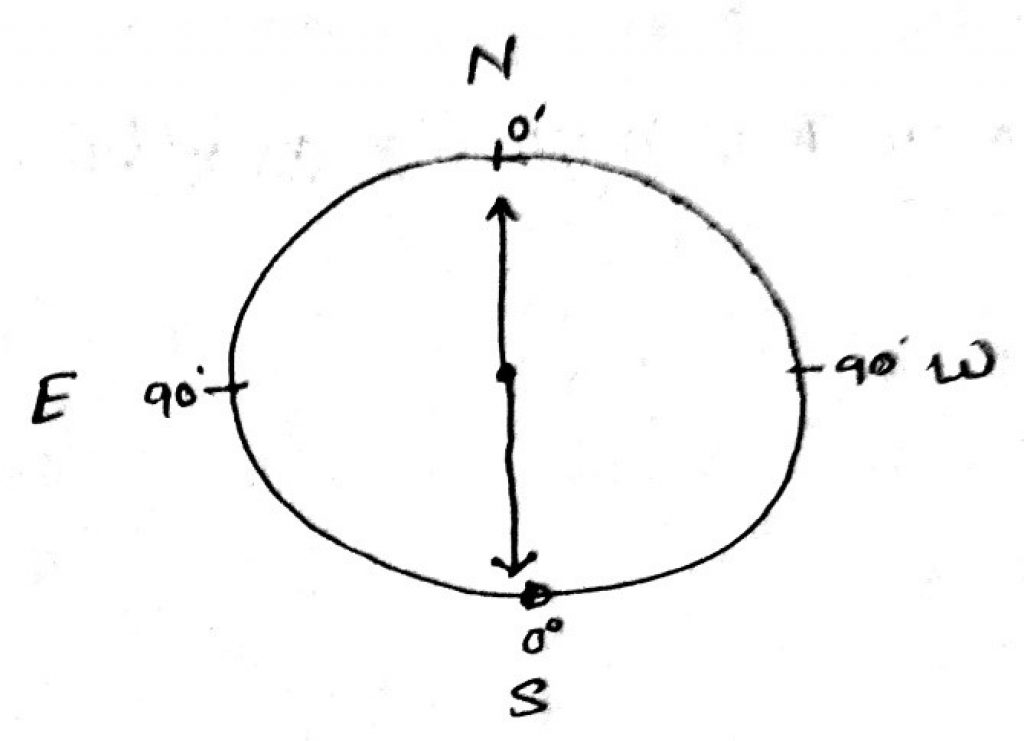
SURVEYOR’S COMPASS- This types of compass formerly used for land survey but now a days it is little used. It is like to a prismatic compass but instead of prism it has plain sight having narrow vertical slit and in place of attach graduated and needle it carries edge bar needle. The graduation are marked both in clock wise and anti-clock wise direction dividing the graduated ring into four quadrant and the graduation are numbered from 0 degree to 90 degree each quadrant. Zero point are marked at north and south and 90 degree at east or west. The object are sighted first and then bearing are observe with marked eye by going vertically over the box.