Researchers from GNS Science in New Zealand announced that they’d mapped the shape and size of the continent in unprecedented detail. They put their maps on an interactive website so that users could virtually explore the continent.
Daily Current Affairs Quiz 2020
Key-Points
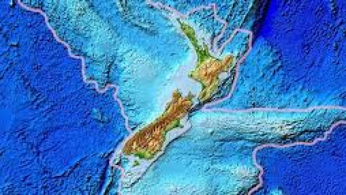
Zealandia is an almost entirely submerged mass of continental crust located in the southern Pacific Ocean that subsided after breaking away from Gondwanaland 83–79 million years ago.
It has variously been described as a continental fragment, a microcontinent, a submerged continent, and a continent.
The land mass may have been completely submerged by about 23 million years ago, and most of it (93%) remains submerged beneath the Pacific Ocean.
Political Divisions Under Zealandia Are: New Zealand, New Caledonia, Norfolk island, Lord howe island group and Elizabeth and Middleton reefs.
It is also known as Tasmantis due to its proximity to Tasman sea. Te Riu-a-Māui is another name for Zealandia.
The name and concept for Zealandia was proposed by Bruce Luyendyk in 1995.