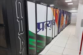
The Indian supercomputers Pratyush and Mihir play a vital role in cutting-edge scientific research and various applications. These powerful computing systems are expertly crafted to tackle intricate calculations, simulations, and modeling tasks that demand a tremendous amount of computational strength.
1. Pratyush: Key Uses
Pratyush, based at the Indian Institute of Tropical Meteorology (IITM) in Pune, plays a vital role in weather forecasting, climate research, and environmental modeling.
Primary Uses of Pratyush:
1. Weather Forecasting:
Real-time weather predictions: Pratyush is essential for forecasting monsoons, cyclones, and various weather patterns, significantly enhancing the accuracy of both short- and long-term forecasts.
– It offers advanced atmospheric models that help predict extreme weather events like floods and droughts, which can impact millions.
2. Climate Change Research: Modeling climate change: Pratyush simulates and forecasts climate patterns, aiding scientists in understanding how climate change affects different regions across India.
– It supports sustainable development initiatives by analyzing long-term environmental data and trends.
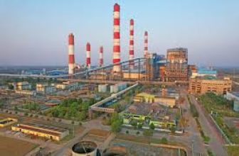
3. Tropical Cyclone Research: This tool is instrumental in refining cyclone prediction models, which are crucial for early warning systems that protect coastal communities.
4. Monsoon Prediction: Pratyush is invaluable for predicting monsoons and agricultural forecasting, providing farmers with essential data on expected rainfall patterns to optimize crop planning.
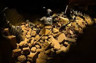
5. Disaster Management:
Assists in developing better systems for disaster management, helping authorities predict and mitigate the impact of natural disasters like floods, cyclones, and storms.
2. Mihir: Key Uses
Mihir, located at the Indian Institute of Remote Sensing (IIRS), Dehradun, focuses on remote sensing, geospatial applications, and analyzing satellite data.
Primary Uses of Mihir:
- Satellite Data Processing:
- Mihir is instrumental in processing and analyzing satellite imagery and data, helping monitor Earth’s surface and atmosphere. This includes environmental monitoring, land use, and climate studies.
- Remote sensing data from satellites helps track natural resources, deforestation, and water bodies.
- Geospatial Applications:
- Mihir supports geospatial analysis for urban planning, agriculture, and land management. It helps develop maps and models for effective management of India’s natural resources.
- Agriculture and Soil Monitoring:
- The supercomputer is used to analyze soil health, crop health, and irrigation patterns, aiding in precision agriculture. This improves the efficiency of agricultural practices, which is essential for feeding the growing population.
- Disaster Monitoring and Mitigation:
- Mihir assists in disaster risk reduction and management by analyzing satellite data to track floods, earthquakes, cyclones, and droughts, providing timely alerts to authorities for better preparedness.
- Climate and Environmental Studies:
- Mihir is used to study climate patterns, land degradation, deforestation, and other environmental challenges facing India. This data helps inform policy decisions related to conservation and sustainability.
- Space Research and Exploration:
- Mihir supports the Indian Space Research Organisation (ISRO) in space missions by providing the computational power needed for analyzing satellite data and space-based observations.